
Let’s help you
plan your journey
Explore responsibly, discover offbeat places, guided by locals, rooted in culture.
Let’s help you
plan your journey
Explore responsibly, discover offbeat places, guided by locals, rooted in culture.
Soumen Bhowmick
Soumen Bhowmick founded Pollen Dots in 2024 to plan journeys across India and Bhutan. He works in the Commercial Department of Indian Railways, where he has been since 2000. From 2016 to 2020 he was Head of Business Development and Partnerships at ScoutMyTrip, a community-driven road trip planning platform. There he built a nationwide network of local Scouts who helped travellers on the road, and grew the Road Trippers Club to 16 Indian cities. As a core member of Devil On Wheels, he helped travellers plan Himalayan trips and started Spreading Smiles. He has driven solo from Arunachal to Goa and from Himachal to Karnataka, and has run his own caravan for more than ten years. His photographs have won national and international salon awards, and his writing has appeared in Outlook Traveller.
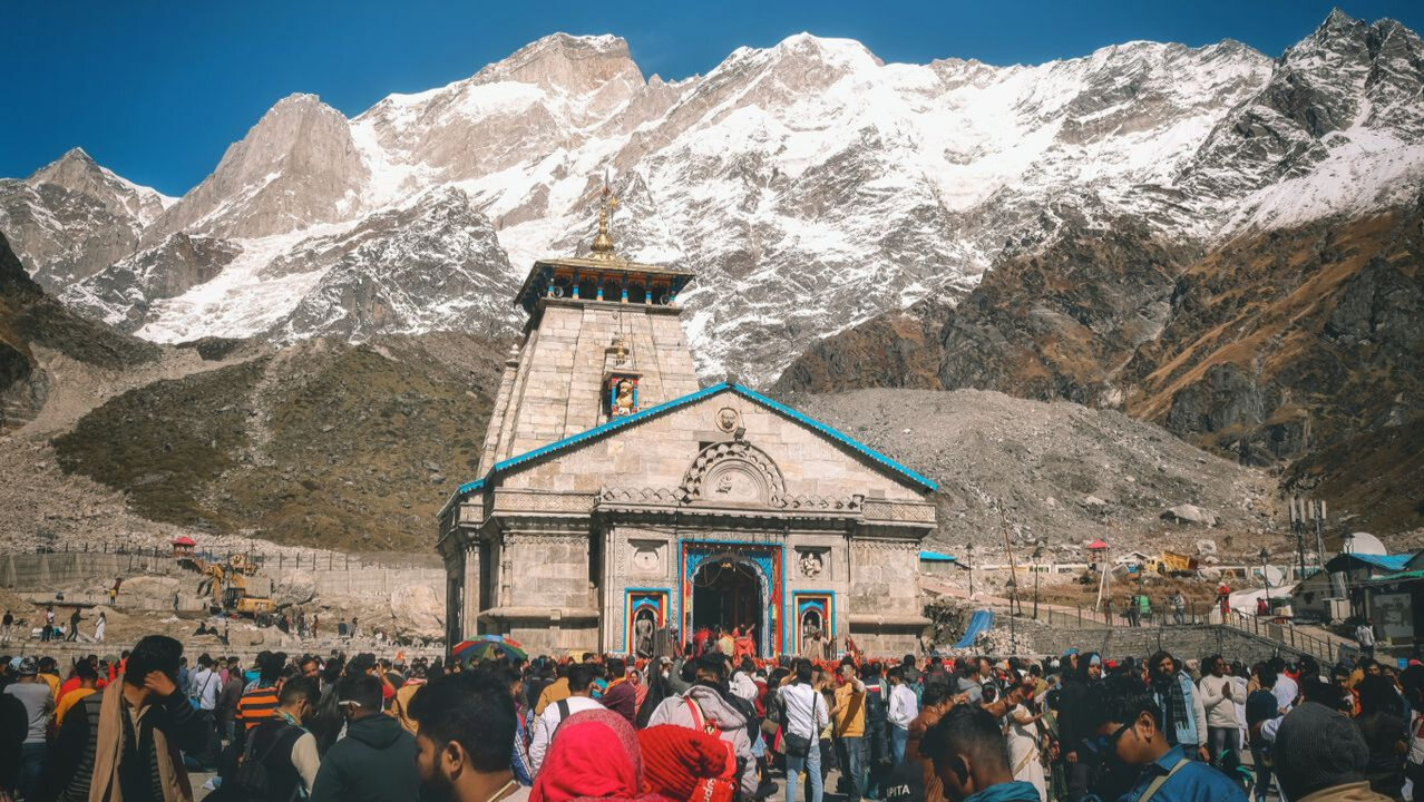
Which half of the state you choose decides most of what you need to settle for a trip to Uttarakhand. The state has had no permanent capital since it was formed in 2000, and runs a winter capital at Dehradun, a summer capital at Bhararisain and a judicial capital at Nainital. Pick Garhwal or Kumaon, check the season, and the permits and the altitude follow from there.
That capital arrangement is a fair picture of the state as a whole. Two divisions, thirteen districts, and a road network that makes the two halves feel like different trips. The guide to preparing for travelling in India opens the general case, and this adds what Uttarakhand does differently.
Four usable windows, and which one suits you depends on whether you are going high or staying in the hill towns.
Thirteen districts in two divisions, and almost everything a traveller wants sits clearly in one or the other.
No permit to enter the state and none for the main circuits, which is where most writing stops. Specified border areas are the exception and Indian citizens need a pass for them.
The useful distinction is that two different things are called an inner line permit. A four-state entry regime, and a district border pass for a handful of valleys. Checking the state and stopping there gets this wrong in both directions.
By road, from one of two entry points, and which one depends on the division you picked.
Most of Uttarakhand sits low enough to ignore. The shrines do not, and the state has a written rule about them.
No other state in this programme attaches an age number to a travel requirement. Our Char Dham and Panch Prayag journey is built around the walking days for that reason, with the altitude placed where there is time to absorb it.
A week gets you one division properly. Trying to cover both in that time produces a driving holiday.
A trip planned on map distances rather than driving hours is the one that fails here, because the road decides the schedule and the season decides the window. Customised tours is where the division, the season and the permits get settled together before anything is booked.
The Niti valley in Chamoli and the Nelang valley in Uttarkashi, where Indian citizens need a pass from the local District Magistrate. The Adi Kailash route in Pithoragarh is issued passes the district administration calls Inner Line Permits. Uttarakhand is not one of the four Inner Line Permit states, which are Arunachal Pradesh, Nagaland, Mizoram and Manipur.
Mid-September to November, with October usually the clearest of them. March to June is better for the hill towns themselves, and the Valley of Flowers opens only from June to October. Avoid July to mid-September, when the monsoon brings landslides.
They are the state's two administrative divisions, covering thirteen districts between them. Garhwal, in the west, holds Dehradun, Rishikesh, Mussoorie and all four Char Dham shrines. Kumaon, in the east, holds Nainital, Almora, Ranikhet and Munsiyari, and most of the state's craft traditions.
The state has no permanent capital. Dehradun is the winter capital, Bhararisain near Gairsain in Chamoli district is the summer capital, declared in 2020, and Nainital is the judicial capital. The permanent capital question has been open since the state was formed in 2000.
A physical medical check-up before the ascent is compulsory for anyone over 55 and for anyone with a history of heart disease, hypertension, asthma or diabetes. You may be asked for a fitness certificate or screened at a checkpoint. There are 31 health check-up centres and 20 Medical Relief Posts on the main trekking routes.
Six to eight days for Kumaon's hill towns, or ten to twelve for all four Char Dham shrines by road. Both divisions without rushing takes sixteen days or more. A week spent trying to cover the whole state becomes a driving holiday.